
Download GPSNavX Marine Navigation – Free Mac Marine Navigation Software
Overview of GPSNavX Marine Navigation
GPSNavX Marine Navigation is a full‑featured marine charting and navigation program built specifically for macOS users. Designed for recreational sailors, professional captains, and anyone who spends time on the water, GPSNavX combines precise GPS integration, detailed nautical charts, and intuitive route planning tools into a single, secure application. The current version, 6.0.7, was released on January 4 2017 and continues to receive regular updates that improve chart accuracy, performance, and user experience.
Available in both English and French, the software supports the latest macOS releases, ensuring that you can enjoy reliable navigation whether you’re cruising along the coast of Maine or exploring the fjords of Norway. With a clean, science‑and‑education‑oriented interface, GPSNavX provides real‑time depth readings, waypoint management, and customizable map layers that make it a valuable companion for any maritime adventure. Though the download count is modest, the feedback from its niche community highlights the app’s stability, low learning curve, and the peace of mind that comes from having a trusted navigation aid on a Mac platform.
Key Features that Set GPSNavX Apart
- High‑Resolution Nautical Charts: Access worldwide vector and raster charts with detailed contour lines, harbors, and navigational aids.
- Real‑Time GPS Integration: Seamlessly connect to external GPS receivers via Bluetooth or USB for live position tracking.
- Route Planning & Optimization: Create waypoints, set courses, and let the software calculate the most efficient routes based on distance, currents, and safety zones.
- Depth Soundings & Tide Tables: View real‑time depth data and integrated tide information for safe passage planning.
- Customizable Map Overlays: Add AIS targets, weather layers, and user‑defined points of interest to tailor the display to your needs.
- Offline Capability: Download charts for use in areas without internet connectivity, ensuring continuous navigation.
- Multi‑Language Support: Interface available in English and French, with the ability to switch languages on the fly.
- Secure Data Storage: All waypoints, routes, and preferences are stored locally with optional encrypted backups.
- Regular Software Updates: Frequent patches address chart updates, bug fixes, and performance improvements.
- User‑Friendly Interface: Drag‑and‑drop waypoint management, intuitive zoom controls, and a clean layout designed for macOS aesthetics.
These features collectively make GPSNavX Marine Navigation a comprehensive tool for anyone who needs accurate, up‑to‑date marine information on a Mac. Whether you are a weekend sailor looking for a simple chart viewer or a seasoned mariner requiring advanced routing capabilities, GPSNavX delivers a balanced mix of depth and simplicity. Its offline mode ensures that you remain charted even when you venture far from shore, while the real‑time GPS integration provides confidence that your position is always accurately plotted. The application’s modular design also means you can start with the core navigation suite and expand with additional overlays as your needs evolve.
Installation, Compatibility, and Everyday Use
GPSNavX Marine Navigation is compatible with macOS 10.12 (Sierra) and later, including macOS Ventura. The software is optimized for both Intel‑based Macs and Apple Silicon (M1/M2) devices, delivering smooth performance across the board.
Step‑by‑Step Installation Guide
- Download the Installer: Click the “Download” button on the official website to obtain the signed DMG file.
- Verify the Signature: Open the Terminal and run
codesign -dv --verbose=4 /path/to/GPSNavX.dmgto confirm the Apple signature for security. - Mount the DMG: Double‑click the DMG file; a virtual drive will appear on your desktop.
- Copy to Applications: Drag the GPSNavX icon into your Applications folder. macOS may prompt you to confirm the move; click “Open” to proceed.
- Initial Launch: Open GPSNavX from the Applications folder. The first run will trigger a permission request to access location services—grant this permission for accurate GPS tracking.
- Configure Settings: In the Preferences menu, select your GPS receiver type (Bluetooth, USB, or NMEA), set default chart layers, and choose your preferred language.
- Download Charts: Use the built‑in chart manager to download the regions you intend to sail. Charts are stored locally, ensuring offline availability.
Everyday Usage Tips
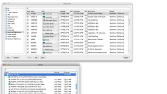
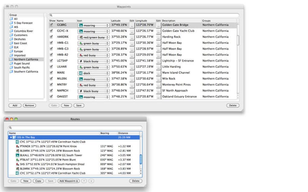
Once installed, GPSNavX becomes a hub for all your navigation activities. Begin by creating a new project and importing the relevant charts for your voyage. Use the “Waypoint” tool to mark points of interest—such as marinas, anchorage spots, or hazards—by clicking directly on the map or entering coordinates manually.
The route planner will automatically calculate distances, estimated time of arrival (ETA), and suggested headings. When you connect a GPS receiver, the app will display your live position as a moving icon, updating your track in real time. To monitor depth, enable the “Depth Soundings” overlay, which pulls data from your GPS device or integrated depth sensors.
For safety, enable the “AIS Targets” layer to view nearby vessels equipped with Automatic Identification System transponders. The interface also offers a quick‑access toolbar for zooming, toggling overlays, and taking screenshots of your current view—useful for sharing plans with crew members.
Maintenance is straightforward: the built‑in updater checks for new chart releases and software patches each time you launch the application with an internet connection. Regular updates keep your charts current and address any bugs that may arise, ensuring that the navigation experience remains reliable and secure.
Pros and Cons – A Balanced Review
Pros
- Free full‑version download with no hidden subscription costs.
- High‑resolution worldwide charts with offline storage.
- Seamless GPS receiver integration (Bluetooth, USB, NMEA).
- Robust route planning, waypoint management, and depth sounding features.
- Multi‑language support and intuitive macOS‑native UI.
- Regular updates that keep charts and software secure.
Cons
- Installation size and system requirements are not listed, which can be confusing for users with limited storage.
- Occasional performance slowdown on older Mac models when loading large chart areas.
- Limited community support compared to larger commercial navigation suites.
- No built‑in weather routing or advanced AIS analytics.
- Last major version update was in 2017; while stable, some users may expect more frequent feature releases.
Frequently Asked Questions & Final Thoughts
Is GPSNavX Marine Navigation really free?
Yes, the full version of GPSNavX Marine Navigation can be downloaded and used at no cost. There are no hidden subscription fees or premium upgrades required for core functionality.
Which macOS versions are supported?
The application supports macOS 10.12 (Sierra) and later, including the latest macOS Ventura. It runs on both Intel‑based and Apple Silicon Macs.
Can I use GPSNavX without an internet connection?
Yes. Once you have downloaded the required charts, the software works completely offline, allowing you to navigate in remote areas without Wi‑Fi or cellular service.
How do I update the nautical charts?
Charts can be updated through the built‑in chart manager. When you launch GPSNavX with an internet connection, it will prompt you if newer chart versions are available, and you can download them directly within the app.
What type of GPS receivers are compatible?
GPSNavX works with most standard marine GPS receivers that support Bluetooth, USB, or NMEA 0183 output. Common brands like Garmin, Raymarine, and Lowrance are fully supported.
Conclusion – Should You Download GPSNavX Marine Navigation?
If you are a Mac user looking for a reliable, feature‑rich marine navigation tool without the burden of recurring fees, GPSNavX Marine Navigation is a compelling choice. Its combination of detailed charts, real‑time GPS integration, and offline capabilities delivers a professional navigation experience that rivals many paid alternatives. While the lack of recent feature updates and occasional performance hitches on older hardware may give some users pause, the overall stability, ease of use, and zero‑cost licensing make it an excellent addition to any sailor’s toolkit. Download GPSNavX today, set up your charts, and enjoy confident, secure voyages on the water.
Click here to download GPSNavX Marine Navigation for free and start charting your next adventure.